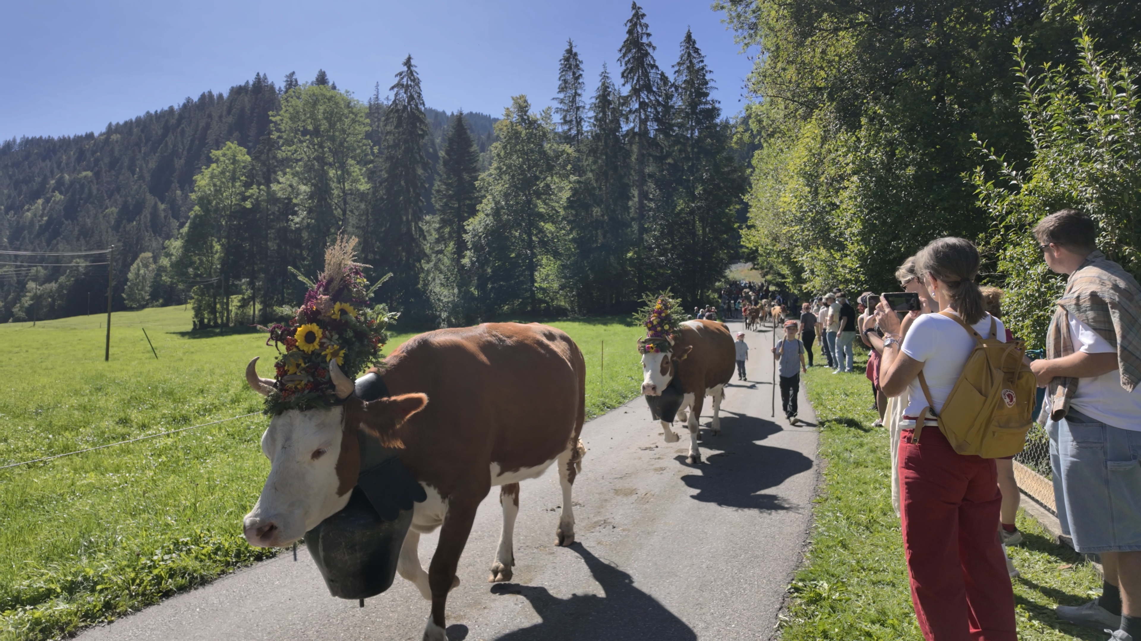
We were staying in St. Stephan, a few stops down the valley from Lenk, because my aunt has an apartment there. That particular trip happened to line up with the Alpabfahrt taking place in the village the next day, the yearly procession where the cattle get walked down from the alp, decorated and all, which is its own story I have written about separately. St. Stephan is the kind of village where you notice the mountains before you notice anything else, and where there is genuinely almost nowhere to eat, so every dinner meant a short train ride or drive over to Zweisimmen instead. That is what first put the Simmenfälle on our radar at all. You cannot spend a week in the Obersimmental without someone mentioning the waterfalls at the end of the Lenk valley, and once you have seen the photos, you stop asking whether it is worth the detour and start asking which route to take.
That turned out to be the actual question worth answering, because there is not just one way to see the Simmenfälle. There is a short version you can do in trainers with a stroller, and there is a full day version that will leave your legs sore for two days afterward. I have now done versions of both, and this is the guide I wish someone had handed me before that first trip from St. Stephan.
What the Simmenfälle Actually Are

The name causes more confusion than it should. You will see it written as Simmenfälle, and you will also see the older spelling, Simmenthaler Fälle, which comes from Simmenthal, how the valley itself was spelled before Switzerland standardized its spelling in the 1930s. Both point to the same place, at the very end of the valley behind Lenk, where the infant Simme river comes crashing down over a series of rock steps roughly 200 meters high in total.
The water itself has a nice origin story. A short walk above the falls, glacier meltwater from between the Wildstrubel and Rohrbachstein peaks surfaces through seven limestone openings in the rock, a spot locals call Sibe Brünne, or Seven Springs. In high summer, that spring alone can push out close to 2,800 liters of water every second. Local history says the name of the springs, Sibe Brünne, slowly shifted over generations into Sibne and then Simme, which is where both the river and the entire Simmental valley got their name. So in a very real sense, this one spot up behind Lenk is where the whole valley we were staying in actually starts.
Getting to St. Stephan, Zweisimmen and Lenk First
If you are coming from Bern or Lake Thun, the way in is the narrow gauge line that runs from Zweisimmen through St. Stephan and on to Lenk, part of the same railway that continues all the way to Montreux on the other side of the mountains. Zweisimmen is where the regular SBB trains from Spiez hand off to this smaller line, and it functions as the actual hub of the valley, with more shops and restaurants than the villages around it. St. Stephan, one stop further on, is much quieter. Most people who do know the name know it for its ski jumping hill, or for the Alpabfahrt if their timing happens to match ours, rather than for a lively main street. When we stayed there we ended up back on the train to Zweisimmen most evenings simply because there was not much open near the apartment after dark.
Lenk itself is the last real village in the valley and the natural base for the falls. Having a car genuinely makes this easier, since you can drive right up to the end of the valley yourself, but a PostAuto bus does run from the Lenk train station up to the falls too, so skipping the rental is entirely doable, just check the timetable in advance since it thins out on weekends.
Parking, the Honesty Fridge and the Cows
Where most people actually end up parking is at Camping Hasenweide, right at the end of the valley at the foot of the Wildstrubel massif and a few minutes on foot from the falls themselves. Parking there is free, but it runs on a donation system with a cash box, so bring coins rather than assuming you can pay by card or leave without paying at all.

The campsite also keeps a self-service fridge stocked with Swiss cheese and drinks, including Cola and Rivella, the caramel-colored soda that is more or less Switzerland’s national soft drink. There is no till and no one watching. You take what you want and leave cash for it, which is a small thing, but it is one of those moments that says more about Swiss trust culture than any guidebook paragraph could. Bring coins here too, since it is cash only.
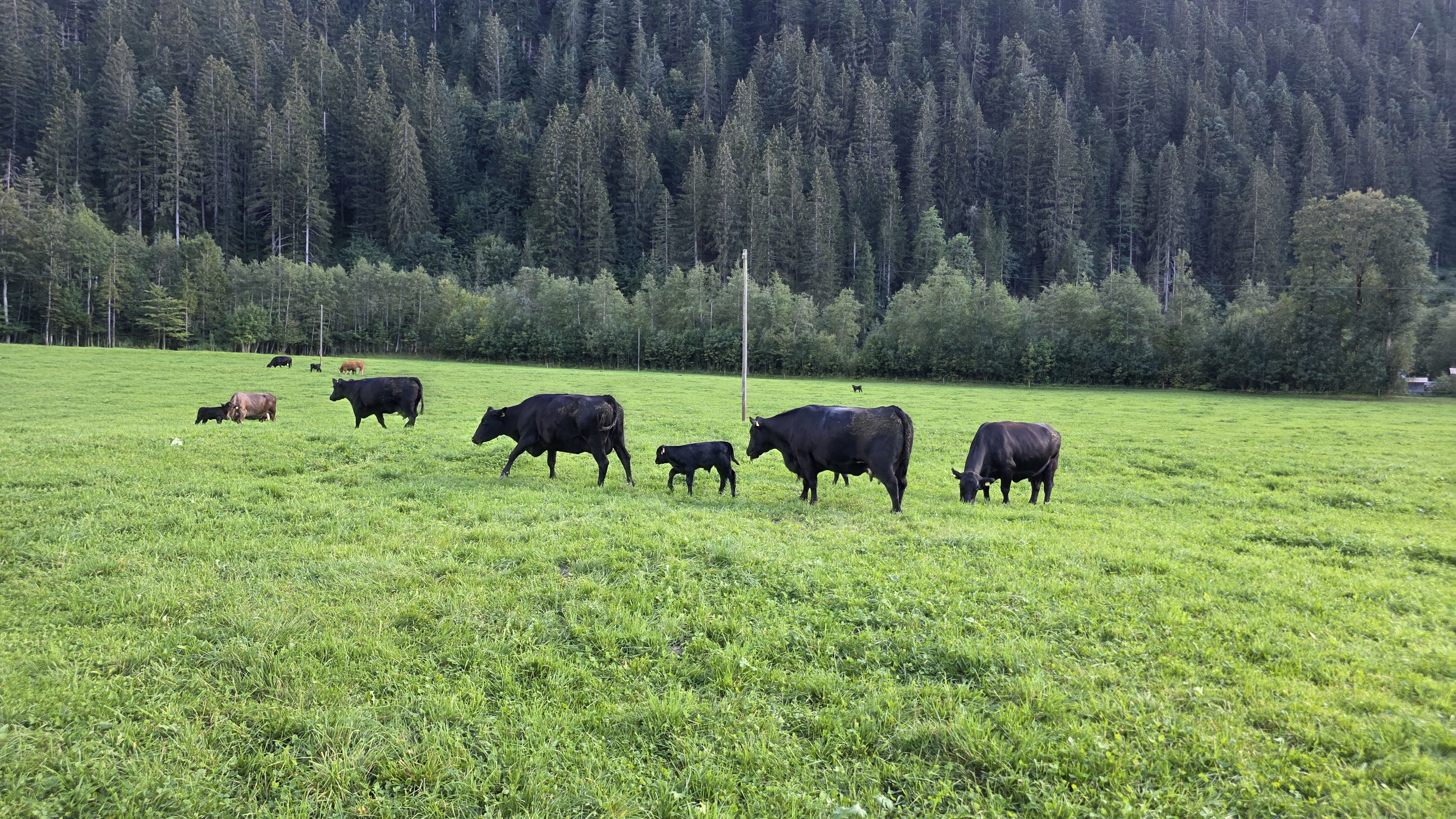
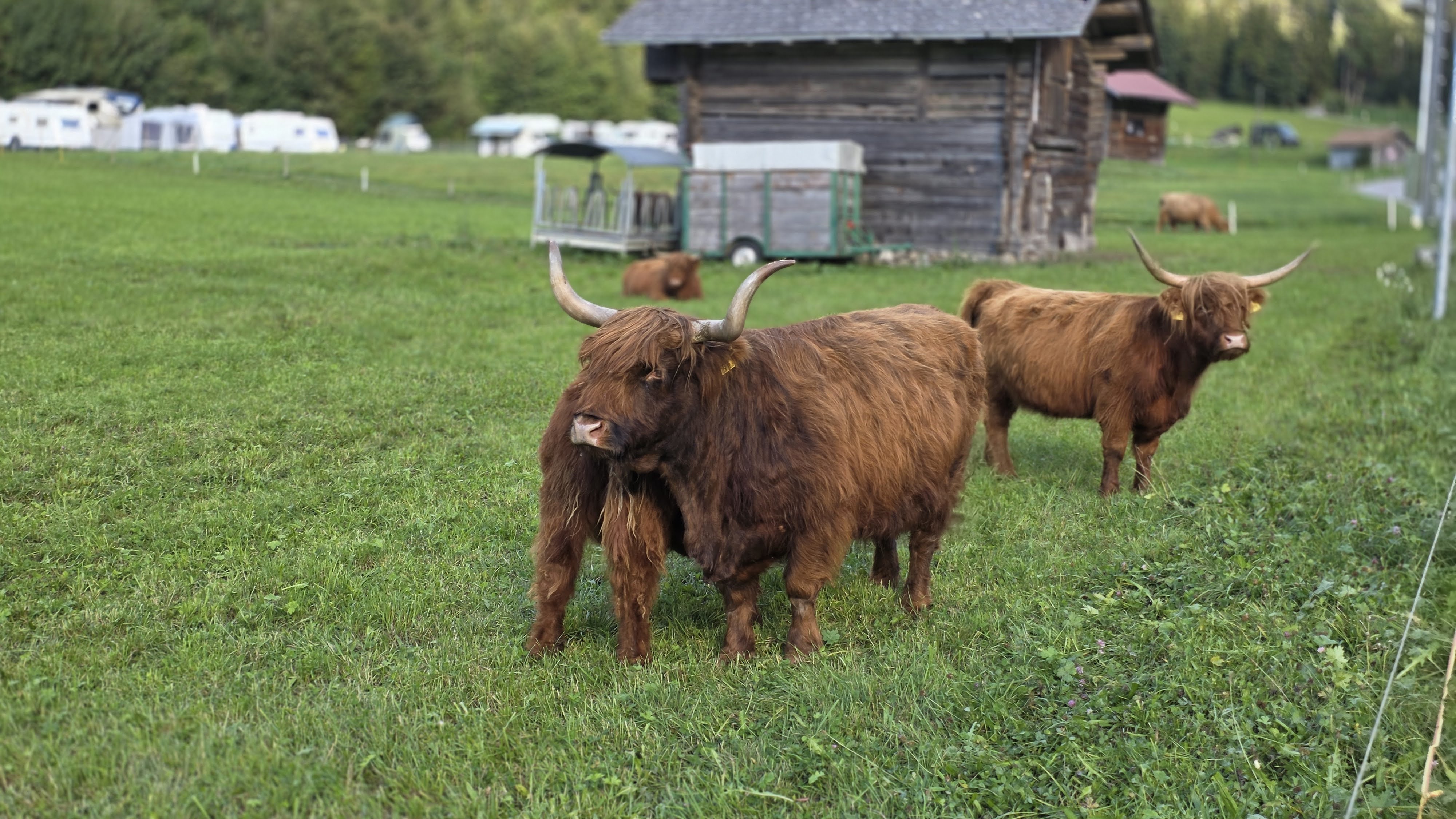
Right below the camping, there is also a pasture worth slowing down for even if you are not stopping. We watched Black Angus cattle grazing there with their calves, alongside a shaggier, long haired breed called Highland cattle that looks almost prehistoric next to them. It is a genuinely good spot for photos before or after the walk up to the falls, and the kind of detail that never makes it into the official trail descriptions.
The Walk Up to the Falls
From the camping, it is about a three minute walk to the actual start of the trail up to the Simmenfälle. From there you have two options, and they work best as a loop rather than a there-and-back. The direct path runs close to the falls themselves and gets you to the top in around 24 minutes, but it is narrow and set up as a one-way route, so this one is best done in dry conditions when the rock underfoot is not slick with spray. The alternative is the path that swings around instead of hugging the falls directly. It takes a little longer but is noticeably easier underfoot, not genuinely difficult at any point, and it is the one I would take back down regardless of which way you go up.
At the top, the path crosses a footbridge right over the water. It is slippery, often cold even in summer, and you will get wet from the spray, so do not wear anything you mind getting damp. If you have the legs for more, you do not have to stop there either, the trail keeps going further up toward the huts above, where you can sit down for a proper lunch with the valley spread out below you before heading back down.
Climbing Higher to Sibe Brünne
Once you have crossed that footbridge, the next step up is the loop that takes you all the way to Sibe Brünne itself. The easiest way to start it is the Stand-Xpress gondola out of Lenk, which carries you up to Metsch. From there the trail runs nearly flat toward Louene before a genuinely steep climb up through the Bummerebach valley to a small mountain restaurant called Nessli Beizli, with the cliff faces of the Ammertehore rising above you the whole way. After that the path opens onto wide alpine meadows and descends to Sibe Brünne, where you can actually stand at the source and watch the springs surface out of the rock, before following the young river back down past the Barbara Bridge to where you started. It is a proper hike with real elevation, but the cable car ride up takes the worst of the climbing out of it, which makes this the route I would recommend to anyone reasonably fit who wants more than the short walk without committing to a full day.
Going All the Way to Iffigenalp
If you want the whole valley in one push, this is the version. Starting from Lenk or the Simmenfälle parking area, the full loop runs close to twenty kilometers with around 900 meters of climbing and the same coming back down, and realistically takes something like six hours once you factor in stops. Past the falls and Sibe Brünne, the trail climbs again over the Rezliberg meadows before a second steep section up to Langermatte, where a mountain hut called Alpbeizli Langermatte is usually the best excuse to stop for something hot. From there the route continues to Iffigenalp and the Iffigfall, a second waterfall dropping more than a hundred meters on its own, before looping back down into the valley. This is not a walk to start late in the day. Weather in this part of the Bernese Oberland tends to build through the afternoon, and starting early gives you the best light on the falls anyway, long before the day groups arrive from the valley floor.
The Winter Version
The Simmenfälle do not close down once the snow arrives, and honestly the winter walk might be the most underrated way to do this. A signed winter trail runs in a loop of about 9.6 kilometers from Lenk past the Lenkersee, a small lake that almost never freezes over completely, and on to the falls and back, with barely 70 meters of elevation change and a groomed, mostly flat surface the whole way. It takes under three hours, works fine in normal winter boots, and gives you a completely different version of the falls, half frozen and steaming in the cold air, with the Gasthof at the end for something warm before the walk back.
When to Go for the Most Water
Because the Simmenfälle are fed by glacier and snowmelt rather than rainfall alone, timing genuinely changes what you see. Early to mid summer, once the high snowpack really starts letting go, is when the falls and the Sibe Brünne springs are at their most dramatic, with far more volume than you will see by late August or September. That said, an early summer visit also means more spray, colder water if you get close, and occasionally trails still soft with runoff higher up toward Iffigenalp, so pack accordingly. If a big, powerful waterfall is the whole point of the trip, aim for June or July. If you would rather have quieter trails and drier footing, the shoulder months work fine too, the falls are simply a little less thunderous.
Where We Actually Ate
This is where the St. Stephan and Zweisimmen split became a running theme for us. St. Stephan is lovely to sleep in and wake up in, but on more than one evening we struck out looking for somewhere open and ended up back on the train to Zweisimmen, which has enough restaurants around the main street and station to actually choose between. Up at the falls themselves, Camping Hasenweide’s honesty fridge covers you for cheese and a cold Rivella before or after the walk, and it is worth timing a stop there either way. Higher up on the loop routes, Nessli Beizli and the Alpbeizli Langermatte hut are both worth timing your hike around rather than treating as an afterthought, since mountain restaurant hours in this valley can be shorter and more weather dependent than you would expect from the villages below.
What to Bring
Pack sturdy shoes with real grip, since the paths closest to the falls get genuinely wet and slippery from the spray even in good weather, and the footbridge at the top is worse than the trail itself. A light rain layer earns its place up there regardless of the forecast. Bring coins, plural, not just a note, since both the parking donation box at Camping Hasenweide and the honesty fridge only work with cash, and cash still matters at the smaller mountain restaurants along the higher routes too. If you are heading for Iffigenalp or the full loop, start early enough that afternoon weather does not catch you high up on an exposed section.
Why I Keep Coming Back
What sold me on the Simmenfälle in the end was not any single viewpoint, it was how much the place changes depending on which version you do. The short walk up from Camping Hasenweide is a genuinely easy outing that still puts you close enough to a 200 meter waterfall to feel the spray on your face. The loop through Sibe Brünne shows you where all that water actually comes from. And the full push to Iffigenalp turns the whole thing into a proper Bernese Oberland day in the mountains. Staying down the valley in St. Stephan, with Zweisimmen as our default dinner spot, turned out to be a good base for exactly that kind of flexibility, close enough to Lenk for an early start, quiet enough to actually rest in between.
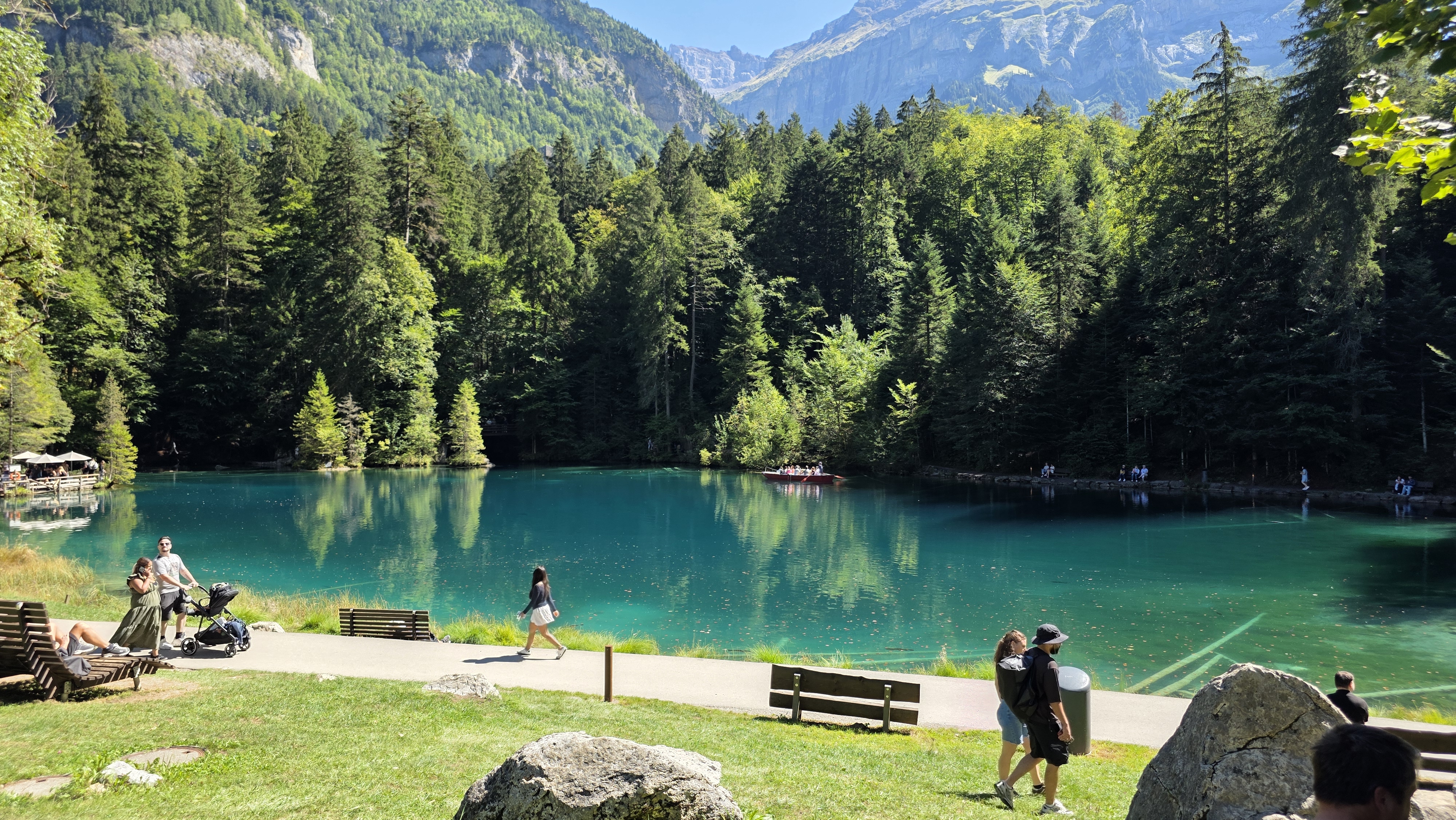
If you are planning the wider trip around it, our Switzerland travel guide is a good starting point for the rest of the country. For two more Bernese Oberland stops that pair naturally with a Simmental trip, our guides to Oeschinensee and Blausee cover the region’s other must-see alpine water, both an easy detour if you are already basing yourself around Lenk or Kandersteg.
Author

Get My Personal Travel Maps
Keep Reading: More Articles You’ll Love
 Alpabfahrt St. Stephan: History, Cows & Visitor Guide
  Oeschinensee Switzerland: My Complete Guide
  Blausee Switzerland: My Complete Guide
  Rainbow Disco Club Festival 2025: The Ultimate Guide to This Izu Music Festival
  Hiking to Heidi’s Alp Above Maienfeld: The Real Village Behind the Story
  Matsumoto Itinerary: The Perfect 3-Day Guide Including Kamikochi
  Jeongdongjin’s Coastal Legends: The Ship and the Shore


Leave a Reply